New resource on high street vacancies
Data from the new Building Blocks: Data by City project.
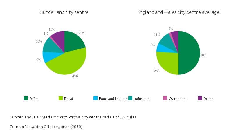
The Centre for Cities has recently launched a online map called Building Blocks: Data by City that allows users to compare over 50 UK cities in terms of types of commercial land use, percentage of high street vacancies and other fun metrics which demonstrate what’s happening on the high street. You can compare cities to each other, as well as to the UK-wide average.
You might find the data useful for your journalism reporting or also for your research in Business, Tourism, Sociology and more.


